Linville Falls

Updated: April 2019
Spectacular Falls with Several Scenic Overlooks
The Cherokee Indians called the Linville River, which runs over the falls, Ee-see-oh, “river of many cliffs.” Linville Falls is a 4-step tiered waterfall with a total height of 150 feet (46 meters). Although not very steep, it is the largest waterfall by volume on the Northern Edge of the Blue Ridge Mountains. Its beauty made it one of the most visited waterfalls in North Carolina.
Two main hiking trails lead to beautiful views of Linville Falls. Both begin at the Linville Falls Visitor Center and range from moderate, the Erwins View Trail, to strenuous, the Linville Gorge Trail and the Plunge Basin Trail. Please use your discretion. Hiking boots are recommended.
Erwins View Trail (moderate 1.6-mile round trip)
The Erwins View Trail offers hikers four overlooks showing different features of the Linville Falls area. After a moderate 0.5-mile walk from the Visitor Center, you reach the first overlook, where the Linville River spills gently over the Upper Falls, widens, pauses and then drifts into a narrow canyon, the water suddenly spiraling out of sight plunging 45 feet (14 meters) over the Lower Falls.
Named for the chimney-like outcroppings located to the right of the waterfall, the Chimney View Overlook offers picturesque views of the Upper and Lower Falls. The trail is strenuous in this section with considerable elevation gain.
At the Gorge View Overlook, hikers can see the Linville River cutting its way through the Linville Gorge Wilderness Area.
The Erwins View Overlook at the end of the 0.8-mile trail offers panoramic views of Linville Gorge and a distant view of the upper and lower falls, which also is a favorite spot for photographers.
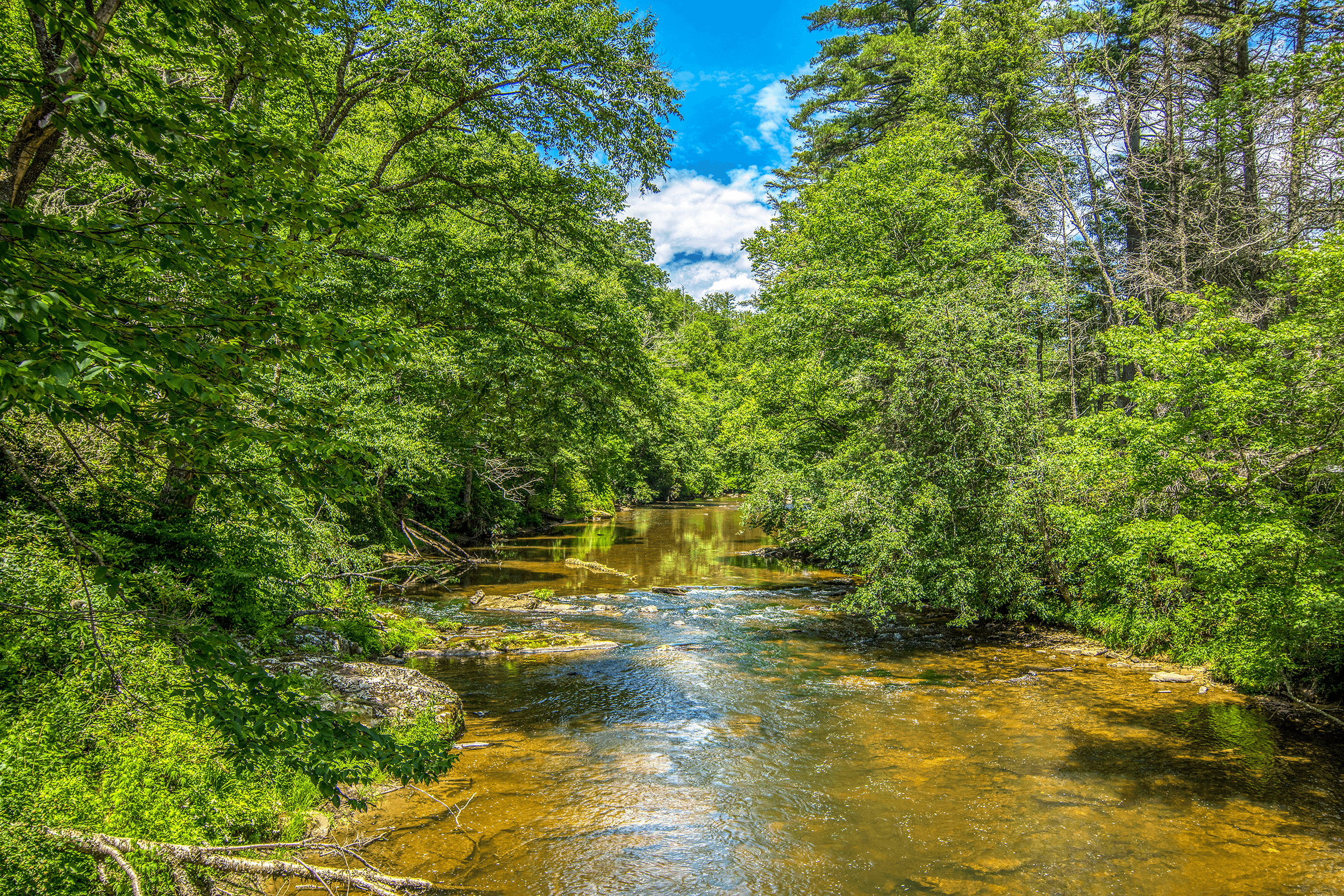
The Linville River, which flows over the falls, was called by the Cherokee Indians Ee-see-oh, “river of many cliffs.”

The Upper Falls Viewing Platform is an easy 0.5-mile (0.8 km) hike up from the Visitor Center. It offers picture-perfect views of the rather gentle Upper Falls. The Linville River widens here as it would pause before...

...dramatically flowing into a narrow canyon, spiraling out of sight and...
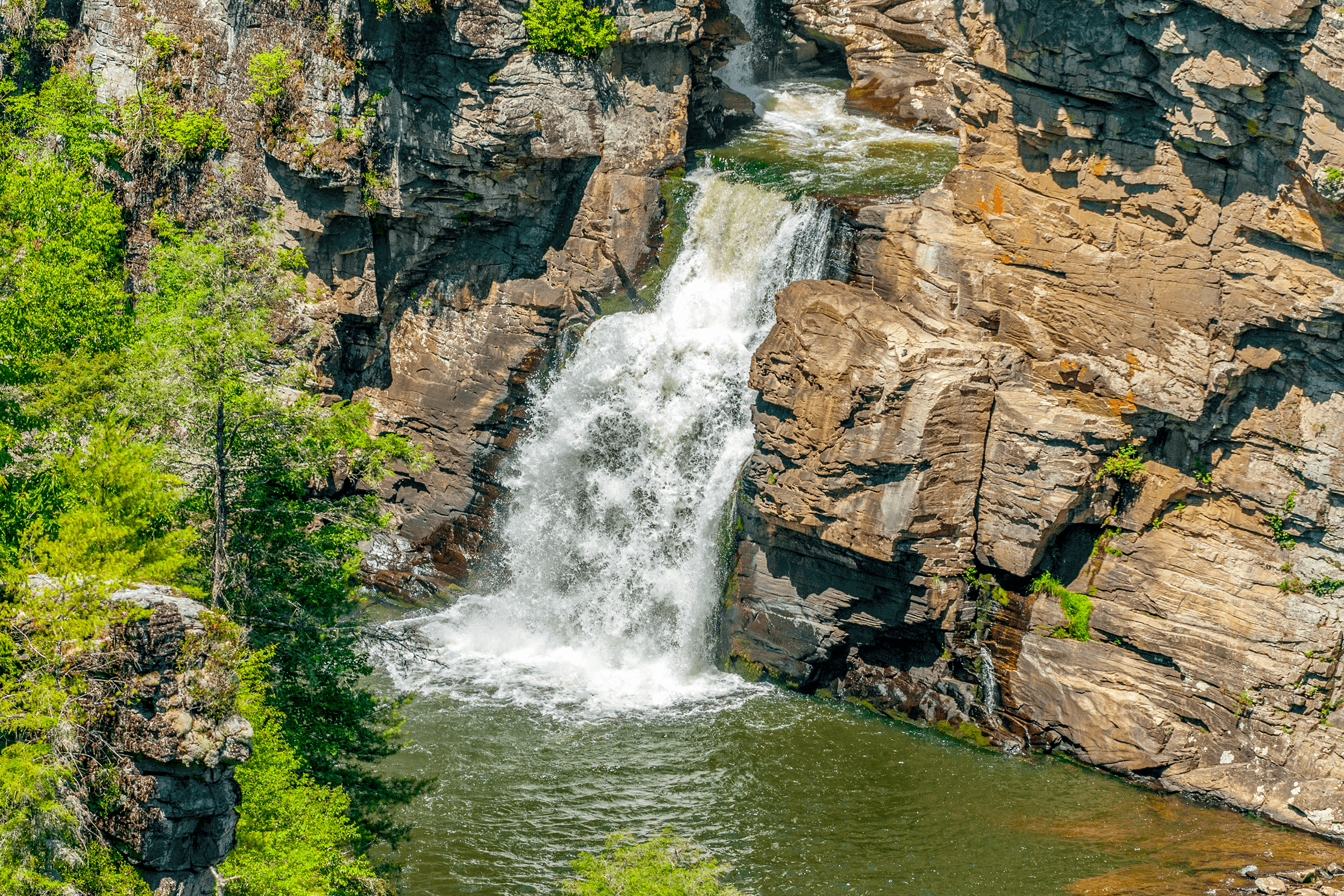
...plunging 45 feet (14 meters) over the Lower Falls.

After a strenuous hike up from Upper Falls, the Chimney View Overlook rewards visitors with picturesque views of the Upper and Lower Falls. The Chimney View Overlook consists of two platforms, one located a little higher than the other.

The second platform at the Chimney View Overlook allows views of the falls from a slightly different angle and stunning views of the Linville River cutting its way through the Linville Gorge Wilderness Area.

From its elevated platform, the Erwins View Overlook offers panoramic views of the falls and the surrounding area.
Linville Gorge Trail (strenuous 1.4-mile round trip)
After a 0.2-mile hike on the Plunge Basin Trail, the Linville Gorge Trail forks off. It winds down through rock cliffs to the bottom of the falls, where the force of the water cascading over the falls has created a large pool.
Plunge Basin Trail (strenuous 1-mile round trip)
The Plunge Basin Trail leads to an overlook where you can view the lower falls and the Chimneys.
William Linville
The falls and the town of Linville are named after early explorers William Linville and his son John, who were killed by Cherokee Indians while camping near the falls in 1766.
History of Linville Falls
The falls were donated to the National Park Service in 1952 by John D. Rockefeller, Jr., who gave the necessary funds to purchase the land including a 1,100-acre (4.5 km²) area surrounding the falls and a part of Linville Gorge.


Blue Ridge Parkway Milepost 316.4, Linville, NC 28647
Directions:
On the Blue Ridge Parkway at Milepost 316.4 turn onto Linville Falls Road (Spur Road). Follow Linville Falls Road south for around 2 miles until you reach the Linville Falls Visitor Center.
Visitor Center:
Tel.: → (828) 765-1045
Dawn to dusk.
Visitor Center:
Mon. to Sun.: 10am to 5pm.
All year.
Visitor Center:
May to October.
Free admission.
At the Visitor Center
For families with children you may want to choose the Erwins View Trail, which goes to the top of the falls. It is a moderate walk. It offers many nice overlooks with beautiful views. Please use your own discretion.
Two main trails: the Erwin View Trail goes to the top of the falls offering many overlooks and is moderate. The Linville Gorge Trail is strenuous as it leads to the bottom of the falls. The Plunge Basin Trail is also strenuous but leads to an overlook. Please use your own discretion.
Restrooms are available at the Visitor Center (May to October). If the Visitor Center is closed, nearest restrooms are 0.4-mile north from the Visitor Center at the Linville Falls Campground.